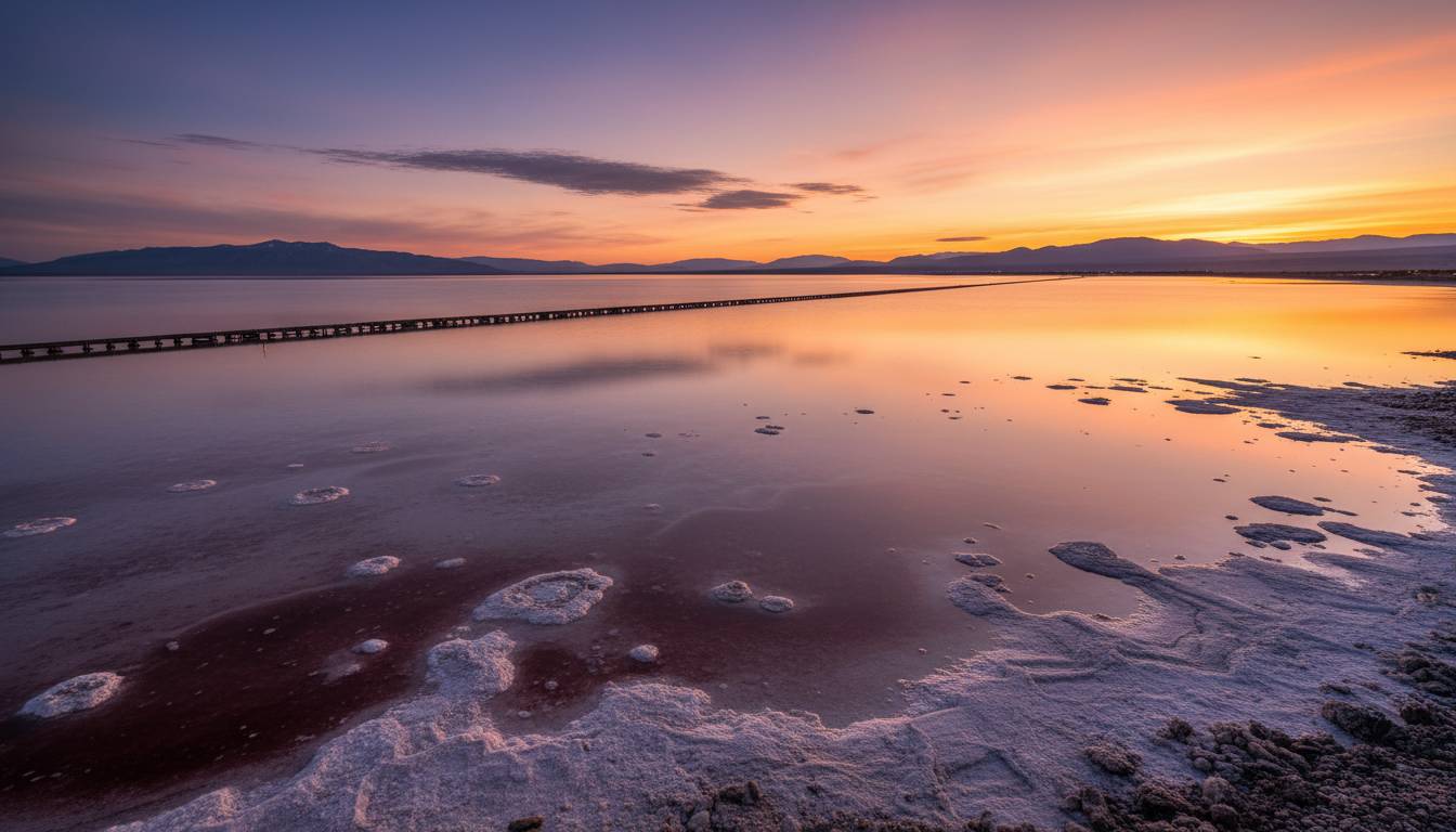
A new University of Utah-led study published on March 10, 2026, points to a surprising feature beneath parts of the Great Salt Lake shoreline: a patchwork of fresh and salty groundwater hidden below the playa. The finding, reported in Geosciences and detailed by EurekAlert on March 12, 2026, suggests the lake’s exposed margins are not uniformly briny and may include shallow freshwater zones only a few meters below ground, helping explain strange reed-covered mounds and “round spots” that have appeared as the lake has receded.
The discovery matters well beyond geology. Scientists say the buried groundwater system could reshape how researchers understand dust formation, salinity movement, and the long-term hydrology of one of North America’s most important terminal lakes. Great Salt Lake is the remnant of prehistoric Lake Bonneville, has no outlet, and has historically supported a highly saline ecosystem, mineral extraction, and major migratory bird habitat across a 35,000-square-mile drainage basin, according to the U.S. Geological Survey.
💡
The “big hidden discovery” is not a buried object but a buried water system.
University of Utah researchers say electrical and hydrologic data show a complex subsurface mix of brine and freshwater beneath Great Salt Lake margins, with freshwater detected at some sites as shallow as about 3 meters below ground, based on results released March 12, 2026.
Key Findings From the 2026 Great Salt Lake Groundwater Study
| Metric | Finding | Source |
|---|---|---|
| Publication date | March 10, 2026 | Geosciences |
| Study methods | 16 ERT lines and 6 TEM surveys | University of Utah / EurekAlert |
| Freshwater threshold | Resistivity above roughly 7 ohm-meters | University of Utah / EurekAlert |
| Shallow freshwater depth | Sometimes as little as 3 meters | University of Utah / EurekAlert |
| Farmington Bay interface | Freshwater-saltwater interface at about 9 meters | Journal of Hydrology coverage |
Source: University of Utah via EurekAlert and Phys.org | Accessed March 25, 2026
16 Survey Lines Mapped a Hidden Water Patchwork
The clearest new evidence comes from geophysical work along the lake’s southern shore. According to the March 12, 2026 EurekAlert release summarizing the paper, researchers processed data from 16 electrical resistivity tomography lines and six transient electromagnetic surveys across three south-shore locations: Burmester, Saltair, and Lee’s Creek. Those measurements were used to infer groundwater salinity because saltier water conducts electricity more easily, while freshwater shows higher resistivity.
The results were not uniform. At Burmester and Saltair, the team found a thick layer of very salty groundwater only a few meters below the surface. At Saltair, that brine appears trapped beneath a hard mirabilite layer, with cracks and vertical pathways allowing brine to move upward. By contrast, near Lee’s Creek, the researchers detected signs of shallow freshwater, in some places only about 3 meters below ground.
That contrast is the core of the story. Instead of one continuous underground brine body, the lake margin appears to contain a heterogeneous system shaped by mountain recharge, local geology, river inputs, and the lake’s repeated rises and falls over thousands of years. The study authors describe the subsurface picture as patchy and complex, not simple.
Why Strange “Round Spots” Triggered the Research
The work gained urgency after researchers observed dozens of unusual mounds and circular wet-looking spots on the exposed lakebed, especially along the eastern margin. These features, often covered with phragmites, appear where artesian groundwater is forced upward through a briny layer under pressure, according to ongoing University of Utah research cited in both the March 2026 EurekAlert release and a January 2026 Phys.org report.
Earlier work tied to the same broader project, reported in the Journal of Hydrology, found a previously unknown freshwater-saltwater interface about 9 meters below the playa in Farmington Bay. Researchers said the size of the circular surface spots correlated with how fresh the water was at the center: larger spots tended to overlie fresher groundwater. That finding helped support the idea that the eastern playa contains pressurized freshwater moving upward through a saltwater lens.
How the Discovery Developed
2023: University of Utah researchers begin electrical resistivity work near the causeway after unusual playa mounds draw attention.
2025: Journal of Hydrology work reports ancient artesian fresh groundwater below the playa and a freshwater-saltwater interface around 9 meters deep in Farmington Bay.
March 10, 2026: Geosciences publishes a new paper on hydrogeologic heterogeneity along the southern shore.
March 12, 2026: EurekAlert details the new findings, including shallow freshwater zones and complex salinity patterns.
How Ancient Water and Modern Decline Intersect
Researchers are still testing where this freshwater came from and how old it is. The University of Utah team says some of the shallow freshwater likely reflects mountain recharge from the Wasatch front and nearby highlands. Some of it could also be a remnant from ancient Lake Bonneville, which covered much of the region until roughly 14,000 years ago. A January 2026 Phys.org report on the same research effort said scientists suspect at least part of the buried freshwater may be ancient.
The timing of the discovery is tied to the lake’s retreat. As Great Salt Lake has shrunk, more playa has been exposed, making it easier to observe surface anomalies and deploy instruments across areas that were previously underwater. Separate hydrology research cited by ScienceDirect notes the lake reached a record low elevation of 4,188.6 feet in 2022, part of a long decline that has intensified concern over dust, habitat loss, and salinity stress.
That broader context matters because Great Salt Lake is not just a local water body. USGS says salinity south of the railroad causeway has historically ranged from 6% to 27%, or roughly two to seven times saltier than the ocean, and the lake supports brine shrimp, brine flies, mineral extraction, and millions of migratory birds. Any new understanding of subsurface water movement could affect how scientists model the lake’s chemistry and exposed sediments.
ℹ️
Scientists are not calling this a new water supply.
University of Utah researchers have cautioned in project coverage that the buried freshwater system is fragile and needs more study before anyone treats it as a usable resource.
What 3 Meters of Freshwater Could Mean for Dust and Lake Science
The practical significance is still being worked out, but one possible implication involves dust. If some exposed playa areas are underlain by shallow freshwater or fed by upward groundwater flow, they may behave differently from fully desiccated salt flats. Researchers have suggested that understanding where freshwater reaches the surface could help explain why some crusts persist, where vegetation appears, and how certain areas might resist wind erosion better than others. That remains an active area of study rather than a settled conclusion.
The discovery also has scientific value beyond Utah. The March 2026 release says terminal lakes around the world are among the most imperiled landscapes, yet groundwater beneath them has received limited study. The University of Utah team described this work as foundational for geophysical research on terminal lakes, which means Great Salt Lake may become a model system for studying how saline surface waters interact with buried freshwater in drying basins.
Frequently Asked Questions
What exactly did the new Great Salt Lake study find?
A paper published March 10, 2026 in Geosciences found that parts of the Great Salt Lake’s southern margin contain a patchwork of fresh and salty groundwater below the playa, rather than a single uniform brine layer. Researchers used 16 ERT lines and six TEM surveys to map those differences.
Is there really freshwater under the Great Salt Lake?
Yes, multiple University of Utah-led research releases indicate freshwater exists beneath parts of the playa, especially along the eastern margin. One earlier study reported a freshwater-saltwater interface at about 9 meters depth in Farmington Bay, while the 2026 Geosciences paper found freshwater signs at some sites as shallow as 3 meters.
Where might that hidden freshwater come from?
Researchers say the most likely sources are mountain recharge and possibly older water left from ancient Lake Bonneville, which covered the region until about 14,000 years ago. The exact age, volume, and recharge pathways are still under investigation using isotope and geophysical methods.
Does this mean Utah has discovered a new water supply?
No. Scientists involved in the project have explicitly cautioned against treating the buried freshwater as a resource to tap before it is fully understood. Their public comments describe the system as fragile and emphasize research on hydrology, dust, and ecosystem implications rather than water development.
Why is this discovery important beyond geology?
Great Salt Lake supports a major saline ecosystem and bird habitat, while its exposed lakebed raises dust concerns as water levels fall. Better mapping of subsurface freshwater and brine could improve understanding of crust stability, salinity transport, and how drying terminal lakes behave under stress.
Disclaimer: This article is for informational purposes only. Information may have changed since publication. Always verify information independently and consult qualified professionals for specific advice.
View 0 comments